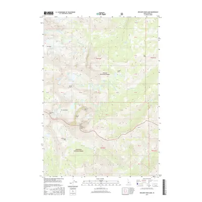
2017 Map of Boulder Chain Lakes
USGS Topo · Published 2017About this map
White Cloud Peaks dominate this high-altitude landscape, where the Challis National Forest and Sawtooth National Forest converge. The topography is defined by a dense concentration of alpine hydrology, most notably the Boulder Chain Lakes system including Lodgepole Lake, Shelf Lake, and Hatchet Lake. These bodies of water occupy glacial cirques and basins carved between formidable summits like Castle Peak and Merriam Peak. The mapping of these remote basins, such as Chamberlain Basin and Four Lakes Basin, reveals a complex network of seasonal drainage and perennial snowfields. To the north, features like The Kettles and Little Redfish Lake illustrate the varied glacial landforms that characterize this wilderness area, providing a detailed record of the high-country drainage into Big Boulder Cr and other tributaries.
Find a feature on this map
82 named features on this map. Tap any name to fly to it.
Don’t see what you’re looking for? This feature index may not catch every label — zoom into the map to look around manually.
Map Details
Editions of this 2017 Boulder Chain Lakes Map
This is the sole edition of this map. No revisions or reprints were ever made.
Other maps of this area

1895 · Hailey
USGS Topo · 1:125,000

1897 · Hailey
USGS Topo · 1:125,000

1900 · Sawtooth
USGS Topo · 1:125,000

1919 · Custer
USGS Topo · 1:125,000

1922 · Custer
USGS Topo · 1:125,000

1929 · Bayhorse
USGS Topo · 1:125,000

1955 · Hailey
USGS Topo · 1:250,000

1957 · Challis
USGS Topo · 1:250,000

1959 · Hailey
USGS Topo · 1:250,000

1960 · Challis
USGS Topo · 1:250,000