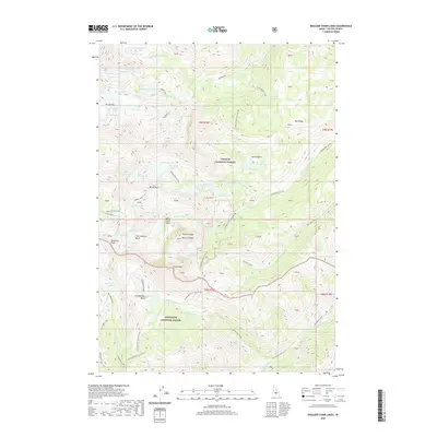
2020 Map of Boulder Chain Lakes
USGS Topo · Published 2020About this map
White Cloud Peaks define the high-elevation landscape of this 2020 survey, where dramatic alpine terrain creates a complex network of glacial cirques and tarns. The area is divided between Challis National Forest and Sawtooth National Forest, highlighting a protected wilderness environment. Prominent summits including Castle Peak, Merriam Peak, and Patterson Peak tower over deep glacial depressions such as Chamberlain Basin and Four Lake Basin. The map reveals the intricate hydrology of the region, specifically the string of tarns known as the Boulder Chain Lakes and the sprawling Big Boulder Lakes system. Historical land management is reflected in features like the Livingston Mill-Castle Divide, while geologic formations such as Serrate Ridge and The Kettles illustrate the powerful impact of past glaciation on the Custer County high country.
Find a feature on this map
75 named features on this map. Tap any name to fly to it.
Don’t see what you’re looking for? This feature index may not catch every label — zoom into the map to look around manually.
Map Details
Editions of this 2020 Boulder Chain Lakes Map
This is the sole edition of this map. No revisions or reprints were ever made.
Other maps of this area

1895 · Hailey
USGS Topo · 1:125,000

1897 · Hailey
USGS Topo · 1:125,000

1900 · Sawtooth
USGS Topo · 1:125,000

1919 · Custer
USGS Topo · 1:125,000

1922 · Custer
USGS Topo · 1:125,000

1929 · Bayhorse
USGS Topo · 1:125,000

1955 · Hailey
USGS Topo · 1:250,000

1957 · Challis
USGS Topo · 1:250,000

1959 · Hailey
USGS Topo · 1:250,000

1960 · Challis
USGS Topo · 1:250,000