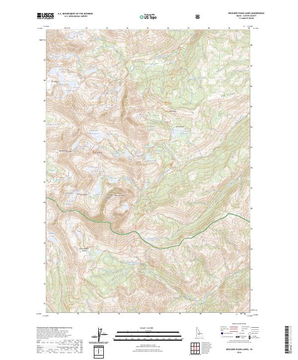
2024 Map of Boulder Chain Lakes
USGS Topo · Published 2024About this map
White Clouds Wilderness dominates this high-elevation landscape within the Challis National Forest and Sawtooth National Forest. The region is defined by sharp topographic features like the White Cloud Peaks, Merriam Peak, and the jagged spine of Serrate Ridge. Water is ubiquitous in the form of alpine basins and creek systems, including the numerous Big Boulder Lakes, Frog Lakes, and the expansive Chamberlain Basin. A dense network of trails, such as the Boulder Chain Lakes Trl and Livingston Mill-Castle Divide Trl, provides the primary means of navigation through the steep terrain. This map documents a preserved wilderness character where the complex hydrology of Big Boulder Creek and its many tributaries, like Gunsight Creek, feeds into larger bodies such as Little Redfish Lake at the edge of the range.
Find a feature on this map
92 named features on this map. Tap any name to fly to it.
Don’t see what you’re looking for? This feature index may not catch every label — zoom into the map to look around manually.
Map Details
Editions of this 2024 Boulder Chain Lakes Map
This is the sole edition of this map. No revisions or reprints were ever made.
Other maps of this area

1895 · Hailey
USGS Topo · 1:125,000

1897 · Hailey
USGS Topo · 1:125,000

1900 · Sawtooth
USGS Topo · 1:125,000

1919 · Custer
USGS Topo · 1:125,000

1922 · Custer
USGS Topo · 1:125,000

1929 · Bayhorse
USGS Topo · 1:125,000

1955 · Hailey
USGS Topo · 1:250,000

1957 · Challis
USGS Topo · 1:250,000

1959 · Hailey
USGS Topo · 1:250,000

1960 · Challis
USGS Topo · 1:250,000