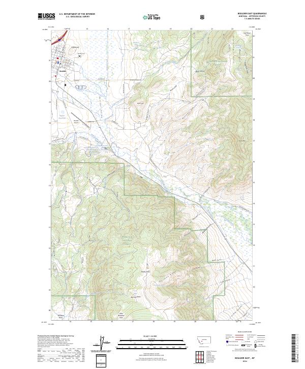
2024 Map of Boulder East
USGS Topo · Published 2024About this map
The town of Boulder serves as a central point in this 2024 survey of the Boulder Valley, where the Boulder River and Little Boulder River converge. The landscape is defined by the significant rise of the Elkhorn Mountains to the east and the protected reaches of the Deerlodge National Forest. Within the town limits, the street grid includes historic names like N Main and E Centennial Ave, while the Boulder Cem sits atop Capital Hill to the north.
Find a feature on this map
80 named features on this map. Tap any name to fly to it.
Don’t see what you’re looking for? This feature index may not catch every label — zoom into the map to look around manually.
Map Details
Editions of this 2024 Boulder East Map
This is the sole edition of this map. No revisions or reprints were ever made.
Other maps of this area

1886 · Fort Logan
USGS Topo · 1:250,000

1889 · Helena
USGS Topo · 1:250,000

1893 · Helena
USGS Topo · 1:250,000

1899 · Boulder
USGS Topo · 1:125,000

1899 · Helena
USGS Topo · 1:250,000

1903 · Helena
USGS Topo · 1:250,000

1947 · Butte
USGS Topo · 1:250,000

1948 · White Sulphur Springs
USGS Topo · 1:250,000

1950 · Devils Fence
USGS Topo · 1:62,500

1950 · Jefferson City
USGS Topo · 1:62,500