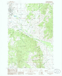
1985 Map of Boulder East
USGS Topo · Published 1986About this map
Boulder serves as the focal point of this Jefferson County survey, situated at the head of the Boulder Valley. The settlement pattern follows the Boulder River and its numerous tributaries, including Muskrat Creek and Farnham Creek. To the south, Boulder Hot Springs stands out as a notable landmark near the foothills. The landscape is heavily influenced by the presence of the Deerlodge National Forest, which blankets the higher elevations of Ryan Mountain and Bull Mountain. Evidence of early and ongoing land use is visible through several Prospect sites, a Placer Mine, and a local Gravel Pit. Notable springs like Killian Spring and Rosie Murphy Spring are named throughout the gulches, while the local Cem is located just outside the main town center of Boulder.
Find a feature on this map
48 named features on this map. Tap any name to fly to it.
Don’t see what you’re looking for? This feature index may not catch every label — zoom into the map to look around manually.
Map Details
Editions of this 1985 Boulder East Map
This is the sole edition of this map. No revisions or reprints were ever made.
Other maps of this area

1886 · Fort Logan
USGS Topo · 1:250,000

1889 · Helena
USGS Topo · 1:250,000

1893 · Helena
USGS Topo · 1:250,000

1899 · Boulder
USGS Topo · 1:125,000

1899 · Helena
USGS Topo · 1:250,000

1903 · Helena
USGS Topo · 1:250,000

1947 · Butte
USGS Topo · 1:250,000

1948 · White Sulphur Springs
USGS Topo · 1:250,000

1950 · Devils Fence
USGS Topo · 1:62,500

1950 · Jefferson City
USGS Topo · 1:62,500