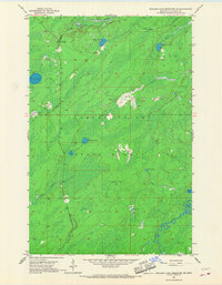
1957 Map of Boulder Lake Reservoir NE
USGS Topo · Published 1967About this map
The Cloquet Valley State Forest dominates this northern landscape, which was meticulously documented in the late 1950s using aerial photographs from 1952. The terrain is characterized by an extensive network of waterways, including the winding Cloquet River and the South Branch Whiteface River, which drain through numerous wetlands and smaller lakes. Evidence of early wilderness management and small-scale settlement is visible at the Cloquet Valley Ranger Station and the outpost of Harris.
Find a feature on this map
18 named features on this map. Tap any name to fly to it.
Don’t see what you’re looking for? This feature index may not catch every label — zoom into the map to look around manually.
Map Details
Editions of this 1957 Boulder Lake Reservoir NE Map
3 editions found
Other maps of this area

1953 · Boulder Lake Reservoir
USGS Topo · 1:24,000

1954 · Barrs Lake
USGS Topo · 1:24,000

1954 · Thompson Lake
USGS Topo · 1:24,000

1954 · Two Harbors
USGS Topo · 1:250,000

1954 · Hibbing
USGS Topo · 1:250,000

1956 · Pequaywan Lake
USGS Topo · 1:24,000

1957 · Two Harbors
USGS Topo · 1:250,000

1957 · Hibbing
USGS Topo · 1:250,000

1957 · Brimson
USGS Topo · 1:62,500

1957 · Markham
USGS Topo · 1:62,500