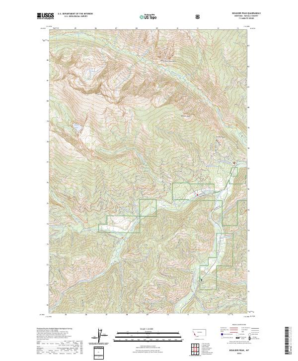
2024 Map of Boulder Peak
USGS Topo · Published 2024About this map
The Bitterroot National Forest dominates this Montana mountain landscape, where the Selway-Bitterroot Wilderness preserves the high country. High-elevation water bodies like Lake of the Rocks and Nelson Lake sit beneath prominent summits including Boulder Peak and Boulder Point. The terrain is defined by steep drainages, such as Beetle Gulch and Barn Draw, which feed into the West Fork Bitterroot River along the eastern edge of the quadrangle.
Find a feature on this map
65 named features on this map. Tap any name to fly to it.
Don’t see what you’re looking for? This feature index may not catch every label — zoom into the map to look around manually.
Map Details
Editions of this 2024 Boulder Peak Map
This is the sole edition of this map. No revisions or reprints were ever made.
Other maps of this area

1956 · Elk City
USGS Topo · 1:250,000

1960 · Elk City
USGS Topo · 1:250,000

1960 · Painted Rocks Lake
USGS Topo · 1:62,500

1960 · Piquett Mountain
USGS Topo · 1:62,500

1964 · Burnt Ridge
USGS Topo · 1:24,000

1964 · Boulder Peak
USGS Topo · 1:24,000
1964 · Trapper Peak
USGS Topo · 1:24,000
1964 · Mount Jerusalem
USGS Topo · 1:24,000
1964 · Tin Cup Lake
USGS Topo · 1:24,000

1964 · Piquett Creek
USGS Topo · 1:24,000