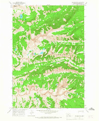
1964 Map of Trapper Peak
USGS Topo · Published 1968About this map
Trapper Peak rises as the dominant landmark of this high-elevation landscape within the Bitterroot National Forest and Selway Bitterroot Wilderness. The terrain is characterized by a dense network of glacial cirque lakes and high peaks, including The Lonesome Bachelor and Sugarloaf Peak. Transport through this protected backcountry is limited to established routes like the Crow Creek (Pack) Trail, reflecting a period of mid-century wilderness management just after the passage of the Wilderness Act.
Find a feature on this map
31 named features on this map. Tap any name to fly to it.
Don’t see what you’re looking for? This feature index may not catch every label — zoom into the map to look around manually.
Map Details
Editions of this 1964 Trapper Peak Map
3 editions found
Other maps of this area

1901 · Hamilton
USGS Topo · 1:125,000

1956 · Elk City
USGS Topo · 1:250,000

1956 · Hamilton
USGS Topo · 1:250,000

1959 · Hamilton
USGS Topo · 1:250,000

1960 · Elk City
USGS Topo · 1:250,000

1960 · Hamilton
USGS Topo · 1:250,000

1964 · Hamilton
USGS Topo · 1:250,000

1964 · Burnt Ridge
USGS Topo · 1:24,000

1964 · Boulder Peak
USGS Topo · 1:24,000

1964 · Darby
USGS Topo · 1:24,000