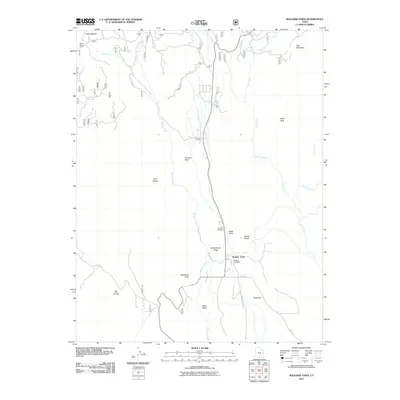
2011 Map of Boulder Town
USGS Topo · Published 2011About this map
Boulder Town serves as the central hub of this remote plateau landscape, where the intersection of the Burr Trl and S Boulder Rd anchors the local community. The settlement is defined by essential civic features like the Boulder Post Office and the Boulder Cemetery, while the surrounding terrain is marked by distinctive geological formations such as Schoolhouse Ledge, Sadies Nipple, and Balancing Rock. Water management is evident through the Tailrace Canal, which divert flows alongside natural drainage systems like Boulder Creek and Deer Creek. To the north, the landscape opens into Haws Pasture and rises toward Deer Mountain, illustrating a high-elevation environment where named draws and hollows, such as Road Draw and Side Hollow, dictate the movement of both water and traveler. This map provides a detailed look at the rural infrastructure and landmarks that define this pocket of Garfield County.
Find a feature on this map
27 named features on this map. Tap any name to fly to it.
Don’t see what you’re looking for? This feature index may not catch every label — zoom into the map to look around manually.
Map Details
Editions of this 2011 Boulder Town Map
This is the sole edition of this map. No revisions or reprints were ever made.
Other maps of this area

1885 · Fish Lake
USGS Topo · 1:250,000

1886 · Escalante
USGS Topo · 1:250,000

1896 · Fish Lake
USGS Topo · 1:250,000

1952 · Notom 3 SW
USGS Topo · 1:24,000

1952 · Notom 3 SE
USGS Topo · 1:24,000

1952 · Grover
USGS Topo · 1:62,500

1953 · Circle Cliffs 2 NE
USGS Topo · 1:24,000

1956 · Escalante
USGS Topo · 1:250,000

1956 · Salina
USGS Topo · 1:250,000

1960 · Escalante
USGS Topo · 1:250,000