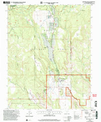
2002 Map of Boulder Town
USGS Topo · Published 2005About this map
Boulder Town sits at the convergence of diverse plateaus and deep watercourses in Garfield County, acting as a gateway between high forest lands and desert monument terrain. This 2002 revision illustrates the community's geographic context, anchored by Anasazi State Park and the vital Boulder Creek corridor. The map reveals a landscape defined by significant topographic shifts, from the elevations of Deer Mountain to the benchlands of New Home Bench and Pretty Tree Bench. Significant infrastructure like the All-American Highway 12 and the Burr Trail connect the isolated settlement to the surrounding wilderness of the Dixie National Forest and Grand Staircase-Escalante National Monument. Local landmarks such as Balancing Rock and Thompson Ledge provide specific orientation points for those studying the transition between agricultural use and protected public lands in the early 21st century.
Find a feature on this map
39 named features on this map. Tap any name to fly to it.
Don’t see what you’re looking for? This feature index may not catch every label — zoom into the map to look around manually.
Map Details
Editions of this 2002 Boulder Town Map
This is the sole edition of this map. No revisions or reprints were ever made.
Other maps of this area

1885 · Fish Lake
USGS Topo · 1:250,000

1886 · Escalante
USGS Topo · 1:250,000

1896 · Fish Lake
USGS Topo · 1:250,000

1952 · Notom 3 SW
USGS Topo · 1:24,000

1952 · Notom 3 SE
USGS Topo · 1:24,000

1952 · Grover
USGS Topo · 1:62,500

1953 · Circle Cliffs 2 NE
USGS Topo · 1:24,000

1956 · Escalante
USGS Topo · 1:250,000

1956 · Salina
USGS Topo · 1:250,000

1960 · Escalante
USGS Topo · 1:250,000