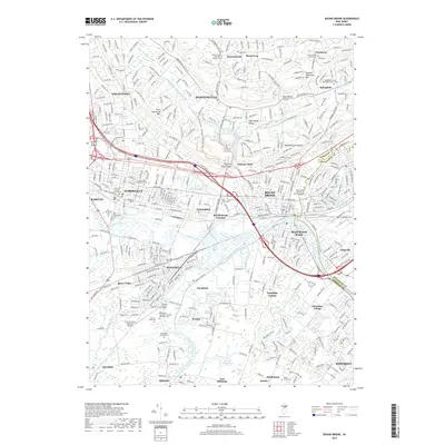
2019 Map of Bound Brook
USGS Topo · Published 2019About this map
The Raritan River and the Delaware and Raritan Canal form the industrial and geographic spine of this Somerset County landscape. The mapping details the dense urban transition from the Somerset County Courthouse in Somerville to the residential heights of Martinsville and Green Knoll. Between the ridges of First Watchung Mtn and Second Watchung Mtn, the Washington Valley Reservoir and Chimney Rock highlight the area's complex drainage and geological relief. For the local historian, the sheet preserves the locations of several burial grounds, including the Van Nest Burying Ground and Old Somerville Cem, alongside smaller settlements like Ukrainian Village and Zarephath that maintain distinct identities within the suburban corridor.
Find a feature on this map
64 named features on this map. Tap any name to fly to it.
Don’t see what you’re looking for? This feature index may not catch every label — zoom into the map to look around manually.
Map Details
Editions of this 2019 Bound Brook Map
This is the sole edition of this map. No revisions or reprints were ever made.
Other maps of this area

1888 · Plainfield
USGS Topo · 1:62,500

1888 · New Brunswick
USGS Topo · 1:62,500

1888 · Princeton
USGS Topo · 1:62,500

1891 · Somerville
USGS Topo · 1:62,500

1893 · New Brunswick
USGS Topo · 1:62,500

1893 · Plainfield
USGS Topo · 1:62,500

1893 · Somerville
USGS Topo · 1:62,500

1894 · Princeton
USGS Topo · 1:62,500

1898 · Plainfield
USGS Topo · 1:62,500

1898 · Somerville
USGS Topo · 1:62,500
Featured Places
- Franklin Township, NJ
- Piscataway Township, NJ
- Bridgewater Township, NJ
- Hillsborough Township, NJ
- Middlesex, NJ