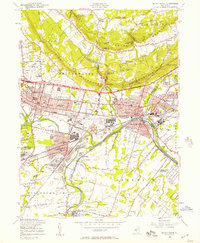
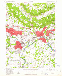
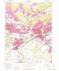
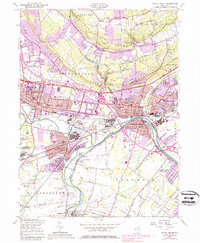
1955 Map of Bound Brook
USGS Topo · Published 1957About this map
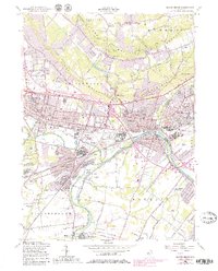
The Raritan River and the parallel Delaware and Raritan Canal anchor this mid-century landscape, where industrial activity and growing residential boroughs meet the steep slopes of First Watchung Mountain. The map reveals a dense network of transit and industry in the towns of Bound Brook, Somerville, and Manville, characterized by the intersecting lines of the Reading Railroad and the Central Railroad of New Jersey.
Find a feature on this map
67 named features on this map. Tap any name to fly to it.
Don’t see what you’re looking for? This feature index may not catch every label — zoom into the map to look around manually.
Map Details
Editions of this 1955 Bound Brook Map
5 editions found
Other maps of this area

1888 · Plainfield
USGS Topo · 1:62,500

1888 · New Brunswick
USGS Topo · 1:62,500

1888 · Princeton
USGS Topo · 1:62,500

1891 · Somerville
USGS Topo · 1:62,500

1893 · New Brunswick
USGS Topo · 1:62,500

1893 · Plainfield
USGS Topo · 1:62,500

1893 · Somerville
USGS Topo · 1:62,500

1894 · Princeton
USGS Topo · 1:62,500

1898 · Plainfield
USGS Topo · 1:62,500

1898 · Somerville
USGS Topo · 1:62,500
Featured Places
- Franklin Township, NJ
- Piscataway Township, NJ
- Bridgewater Township, NJ
- Hillsborough Township, NJ
- Middlesex, NJ