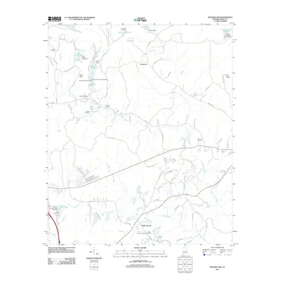
2011 Map of Bounds Lake
USGS Topo · Published 2011About this map
Shelby Springs serves as a prominent focal point in this portion of Shelby County, where the historic Shelby Springs Confederate Cemetery preserves the local legacy of the nineteenth century. The landscape is defined by its numerous small reservoirs and residential developments, including Joinertown and the Rolling Hills Camp settlement. These communities are situated among a network of managed water bodies such as Kimberly-Clark Lake, Bounds Lake, and Four Wing Lake.
Find a feature on this map
92 named features on this map. Tap any name to fly to it.
Don’t see what you’re looking for? This feature index may not catch every label — zoom into the map to look around manually.
Map Details
Editions of this 2011 Bounds Lake Map
This is the sole edition of this map. No revisions or reprints were ever made.
Other maps of this area

1890 · Bessemer
USGS Topo · 1:125,000

1892 · Bessemer
USGS Topo · 1:125,000

1905 · Bessemer Iron District
USGS Topo · 1:62,500

1906 · Vandiver
USGS Topo · 1:62,500

1907 · Bessemer Special
USGS Topo · 1:62,500

1908 · Vandiver
USGS Topo · 1:62,500

1909 · Columbiana
USGS Topo · 1:62,500

1910 · Montevallo
USGS Topo · 1:62,500

1911 · Columbiana
USGS Topo · 1:62,500

1953 · Birmingham
USGS Topo · 1:250,000