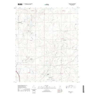
2018 Map of Bounds Lake
USGS Topo · Published 2018About this map
Shelby Springs anchors the southern portion of this landscape, a site with deep roots in the region's mid-19th-century history. The map highlights several significant burial grounds for genealogical research, including the Shelby Springs Confederate Cem, Old Lynch Cem, and the Blackmon Cem south of Columbiana. These sites reflect the long-standing settlement patterns that predate the expansion of modern Alabaster and Calera.
Find a feature on this map
100 named features on this map. Tap any name to fly to it.
Don’t see what you’re looking for? This feature index may not catch every label — zoom into the map to look around manually.
Map Details
Editions of this 2018 Bounds Lake Map
This is the sole edition of this map. No revisions or reprints were ever made.
Other maps of this area

1890 · Bessemer
USGS Topo · 1:125,000

1892 · Bessemer
USGS Topo · 1:125,000

1905 · Bessemer Iron District
USGS Topo · 1:62,500

1906 · Vandiver
USGS Topo · 1:62,500

1907 · Bessemer Special
USGS Topo · 1:62,500

1908 · Vandiver
USGS Topo · 1:62,500

1909 · Columbiana
USGS Topo · 1:62,500

1910 · Montevallo
USGS Topo · 1:62,500

1911 · Columbiana
USGS Topo · 1:62,500

1953 · Birmingham
USGS Topo · 1:250,000