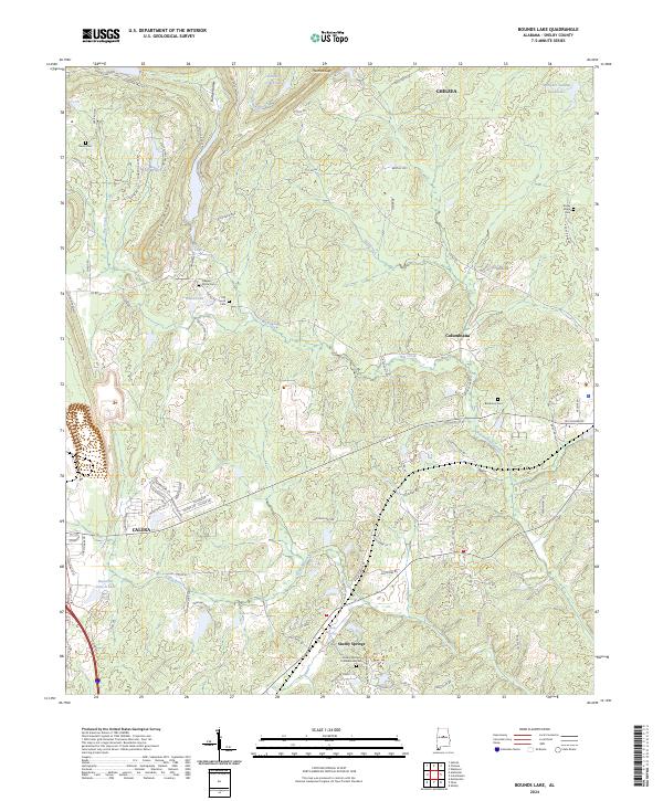
2024 Map of Bounds Lake
USGS Topo · Published 2024About this map
Shelby Springs and the southern outskirts of Chelsea characterize this portion of Shelby County, where the landscape is defined by the sharp transition between the ridges and hollows of the Appalachian foothills. The presence of the Shelby Springs Confederate Cem provides a significant touchstone for researchers of the 19th-century South, located near the junction of Camp Branch and local timberlands. Several small family and historic burial sites, including the Old Lynch Cem and Nearest Grave Cem, are tucked away near White Lake and Big Creek. The terrain is marked by prominent elevations like Boulder Ridge and Story Ridge, while the eastern portion of the map shows the residential and rural expansion near Columbiana. Water features like Pumpkin Swamp and Waxahatchee Creek highlight the natural drainage patterns that have historically shaped settlement in this part of Alabama.
Find a feature on this map
104 named features on this map. Tap any name to fly to it.
Don’t see what you’re looking for? This feature index may not catch every label — zoom into the map to look around manually.
Map Details
Editions of this 2024 Bounds Lake Map
This is the sole edition of this map. No revisions or reprints were ever made.
Other maps of this area

1890 · Bessemer
USGS Topo · 1:125,000

1892 · Bessemer
USGS Topo · 1:125,000

1905 · Bessemer Iron District
USGS Topo · 1:62,500

1906 · Vandiver
USGS Topo · 1:62,500

1907 · Bessemer Special
USGS Topo · 1:62,500

1908 · Vandiver
USGS Topo · 1:62,500

1909 · Columbiana
USGS Topo · 1:62,500

1910 · Montevallo
USGS Topo · 1:62,500

1911 · Columbiana
USGS Topo · 1:62,500

1953 · Birmingham
USGS Topo · 1:250,000