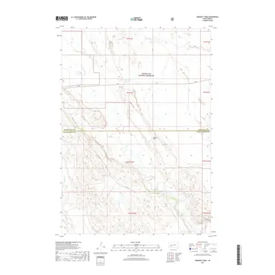
2017 Map of Bouquet Table
USGS Topo · Published 2017About this map
Buffalo Gap National Grassland dominates the northern landscape of this South Dakota survey, illustrating the vast open range typical of the Great Plains. The terrain is defined by the prominent Bouquet Table, a high plateau that rises above the surrounding drainage networks of Cain Cr and Clifford Cr. These seasonal waterways eventually feed toward the White River, which cuts through the southern portion of the quadrangle. The map captures a moment in the modern era where the land is largely managed for conservation and public use, though historical section lines and township markers like t3s r15e indicate the enduring framework of the Public Land Survey System. Human presence is sparse, marked primarily by the Sage Cr Reservoir and a grid of rural routes including SN 44 and Bouquet Table Rd, which serve this remote stretch of the Pennington and Oglala Lakota county line.
Find a feature on this map
19 named features on this map. Tap any name to fly to it.
Don’t see what you’re looking for? This feature index may not catch every label — zoom into the map to look around manually.
Map Details
Editions of this 2017 Bouquet Table Map
This is the sole edition of this map. No revisions or reprints were ever made.
Other maps of this area

1950 · Conata
USGS Topo · 1:24,000

1950 · Conata SW
USGS Topo · 1:24,000

1950 · Imlay SW
USGS Topo · 1:24,000

1950 · Imlay
USGS Topo · 1:24,000

1950 · Imlay SE
USGS Topo · 1:24,000

1950 · Bouquet Table
USGS Topo · 1:24,000

1952 · Bouquet Table
USGS Topo · 1:24,000

1952 · Conata
USGS Topo · 1:24,000

1955 · Hot Springs
USGS Topo · 1:250,000

1960 · Quinn Table SE
USGS Topo · 1:24,000