
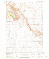
1950 Map of Bouquet Table
USGS Topo · Published 1972About this map
Pine Ridge Indian Reservation and the Badlands National Monument meet in this 1950 survey, showcasing the dramatic topographical transition across the Bouquet Table. The landscape is defined by the sharp erosion patterns of the badlands, contrasted with the more stable high plateaus. Transport through this challenging terrain is anchored by the Chicago Milwaukee St Paul and Pacific railroad, which traverses the northern section of the map near the settlement of Imlay. Evidence of local community infrastructure is found at the Cain Creek Sch, situated near the confluence of Cain Creek and the White River. This map serves as a record of the mid-century intersection between federal land management, indigenous lands, and the rail-dependent economy of South Dakota.
Find a feature on this map
9 named features on this map. Tap any name to fly to it.
Don’t see what you’re looking for? This feature index may not catch every label — zoom into the map to look around manually.
Map Details
Editions of this 1950 Bouquet Table Map
This is the sole edition of this map. No revisions or reprints were ever made.
Other maps of this area

1950 · Conata
USGS Topo · 1:24,000

1950 · Conata SW
USGS Topo · 1:24,000

1950 · Imlay SW
USGS Topo · 1:24,000

1950 · Imlay
USGS Topo · 1:24,000

1950 · Imlay SE
USGS Topo · 1:24,000

1952 · Bouquet Table
USGS Topo · 1:24,000

1952 · Conata
USGS Topo · 1:24,000

1955 · Hot Springs
USGS Topo · 1:250,000

1960 · Quinn Table SE
USGS Topo · 1:24,000
1960 · Wall SW
USGS Topo · 1:24,000