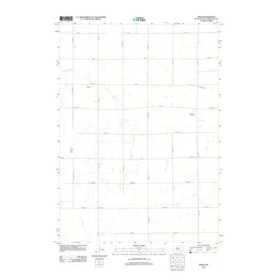
2012 Map of Bovee
USGS Topo · Published 2012About this map
Bovee stands as a small settlement hub in this section of Charles Mix County, anchored by a strict grid of section roads like 280th St and 371st Ave. The landscape is defined by its drainages, where winding watercourses such as Edgerton Cr and Pease Cr cut across the agricultural geometry. These creeks provide natural contours that contrast with the precise township lines, creating a distinct prairie drainage pattern characteristic of this South Dakota region.
Find a feature on this map
23 named features on this map. Tap any name to fly to it.
Don’t see what you’re looking for? This feature index may not catch every label — zoom into the map to look around manually.
Map Details
Editions of this 2012 Bovee Map
This is the sole edition of this map. No revisions or reprints were ever made.
Other maps of this area

1955 · Mitchell
USGS Topo · 1:250,000

1959 · Mitchell
USGS Topo · 1:250,000

1964 · Campbell Creek
USGS Topo · 1:24,000

1964 · Whetstone Bay
USGS Topo · 1:24,000

1964 · Lake Andes NW
USGS Topo · 1:24,000

1977 · Lake Andes NW
USGS Topo · 1:24,000

1979 · Castalia
USGS Topo · 1:24,000
1979 · Bovee
USGS Topo · 1:24,000
1979 · Geddes
USGS Topo · 1:24,000

1979 · Joubert
USGS Topo · 1:24,000