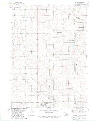
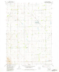
1979 Map of Geddes
USGS Topo · Published 1980About this map
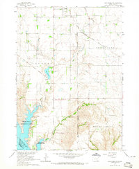
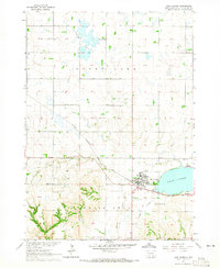
The settlement of Geddes serves as the primary hub on this late-1970s survey, situated at the terminus of a notable transportation corridor. The Chicago Milwaukee St Paul and Pacific railroad tracks cut diagonally across the prairie landscape, connecting the township of Jackson to the rail network. The geography is defined by subtle drainage patterns and wetlands, including Pease Creek and Stolen Lake, alongside several dedicated National Waterfowl Production Area zones.
Find a feature on this map
14 named features on this map. Tap any name to fly to it.
Don’t see what you’re looking for? This feature index may not catch every label — zoom into the map to look around manually.
Map Details
Editions of this 1979 Geddes Map
This is the sole edition of this map. No revisions or reprints were ever made.
Other maps of this area

1955 · Mitchell
USGS Topo · 1:250,000

1959 · Mitchell
USGS Topo · 1:250,000

1964 · Campbell Creek
USGS Topo · 1:24,000
1964 · Lake Andes NW
USGS Topo · 1:24,000
1964 · Lake Andes
USGS Topo · 1:24,000
1977 · Lake Andes NW
USGS Topo · 1:24,000
1977 · Lake Andes
USGS Topo · 1:24,000
1979 · Bovee
USGS Topo · 1:24,000
1979 · Geddes SE
USGS Topo · 1:24,000
1979 · New Holland
USGS Topo · 1:24,000