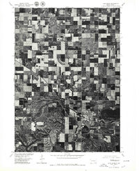
1977 Map of Lake Andes
USGS Topo · Published 1979About this map
Lake Andes serves as the focal point for this 1977 orthophotograph, where the grid of the northern plains meets the southern shoreline of the town's namesake water body. Unlike standard topographic sheets, this imagery, produced in cooperation with the Bureau of Indian Affairs, provides a direct photographic record of the landscape as it appeared in the late 1970s. The image clearly delineates the developed street grid of the Lake Andes settlement and the surrounding patchwork of agricultural fields, which dominate the northern half of the quadrangle. To the south, the terrain transitions into a more textured, dissected landscape, likely influenced by the proximity of the Missouri River valley just beyond the map's edge. This specialized survey is particularly useful for identifying exact land use patterns and the footprint of the community before later modernization.
Find a feature on this map
2 named features on this map. Tap any name to fly to it.
Don’t see what you’re looking for? This feature index may not catch every label — zoom into the map to look around manually.
Map Details
Editions of this 1977 Lake Andes Map
This is the sole edition of this map. No revisions or reprints were ever made.
Other maps of this area

1955 · Mitchell
USGS Topo · 1:250,000

1959 · Mitchell
USGS Topo · 1:250,000

1964 · Ravinia
USGS Topo · 1:24,000

1964 · Lake Andes NW
USGS Topo · 1:24,000

1964 · Fort Randall Dam
USGS Topo · 1:24,000

1964 · Lake Andes SW
USGS Topo · 1:24,000

1964 · Lake Andes
USGS Topo · 1:24,000

1964 · Wagner SW
USGS Topo · 1:24,000
1977 · Wagner SW
USGS Topo · 1:24,000

1977 · Lake Andes NW
USGS Topo · 1:24,000