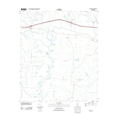
2012 Map of Bovina
USGS Topo · Published 2012About this map
The Big Black River carves a winding path through this portion of Mississippi, defining a landscape of oxbow lakes and bottomlands. Settlements such as Bovina, Smiths, and Institute sit above the flood-prone drainage basins, connected by a network of local roads and the primary east-west interstate corridor. This terrain is marked by numerous hydrologic features, including Old River Lake, Montgomery Lake, and the prominent Tomcat Island, which formed as the river's course shifted over time.
Find a feature on this map
64 named features on this map. Tap any name to fly to it.
Don’t see what you’re looking for? This feature index may not catch every label — zoom into the map to look around manually.
Map Details
Editions of this 2012 Bovina Map
This is the sole edition of this map. No revisions or reprints were ever made.
Other maps of this area

1918 · Vicksburg
USGS Topo · 1:62,500

1938 · Edwards
USGS Topo · 1:62,500

1939 · Yokena
USGS Topo · 1:62,500

1941 · Vicksburg
USGS Topo · 1:62,500

1955 · Jackson
USGS Topo · 1:250,000

1961 · Jackson
USGS Topo · 1:250,000

1962 · Jackson
USGS Topo · 1:250,000

1962 · Redwood
USGS Topo · 1:24,000

1962 · Vicksburg East
USGS Topo · 1:24,000
1963 · Learned
USGS Topo · 1:24,000