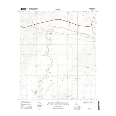
2015 Map of Bovina
USGS Topo · Published 2015About this map
The Big Black River meanders across this landscape on the boundary of Warren and Hinds counties, creating a complex network of oxbows and floodplains. Small settlements like Bovina and Smiths dot the uplands, connected by a mix of modern infrastructure and older routes like Warriors Trl. The hydraulic history of the river is evident in features such as Tomcat Island and Horseshoe Lake, marking where the main channel has shifted over time. Local heritage is preserved in quiet landmarks, including the Montgomery Cem near Montgomery Lake and the Henry Cem further south. The area’s rural character is defined by its numerous water bodies, from Gibbs Lake to Fourteenmile Cr, and long-standing crossings like Askew Bridge. This survey captures the transition from the river's winding natural course to the organized development found at Institute and along major transportation corridors.
Find a feature on this map
61 named features on this map. Tap any name to fly to it.
Don’t see what you’re looking for? This feature index may not catch every label — zoom into the map to look around manually.
Map Details
Editions of this 2015 Bovina Map
This is the sole edition of this map. No revisions or reprints were ever made.
Other maps of this area

1918 · Vicksburg
USGS Topo · 1:62,500

1938 · Edwards
USGS Topo · 1:62,500

1939 · Yokena
USGS Topo · 1:62,500

1941 · Vicksburg
USGS Topo · 1:62,500

1955 · Jackson
USGS Topo · 1:250,000

1961 · Jackson
USGS Topo · 1:250,000

1962 · Jackson
USGS Topo · 1:250,000

1962 · Redwood
USGS Topo · 1:24,000

1962 · Vicksburg East
USGS Topo · 1:24,000
1963 · Learned
USGS Topo · 1:24,000