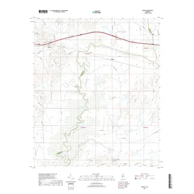
2018 Map of Bovina
USGS Topo · Published 2018About this map
The Big Black River meanders across this landscape, defining the winding boundary between Warren and Hinds counties. This river corridor is characterized by a complex network of oxbow lakes and wetlands, including Old River Lake, Horseshoe Lake, and Little Horseshoe Lake, which reflect the historic shifting of the river channel. The settlement of Bovina sits at the western edge, connected to the wider region by the modern corridor of Interstate 20 and the older Old Hwy 80. To the east, the community of Smiths serves as another focal point for local roads.
Find a feature on this map
65 named features on this map. Tap any name to fly to it.
Don’t see what you’re looking for? This feature index may not catch every label — zoom into the map to look around manually.
Map Details
Editions of this 2018 Bovina Map
This is the sole edition of this map. No revisions or reprints were ever made.
Other maps of this area

1918 · Vicksburg
USGS Topo · 1:62,500

1938 · Edwards
USGS Topo · 1:62,500

1939 · Yokena
USGS Topo · 1:62,500

1941 · Vicksburg
USGS Topo · 1:62,500

1955 · Jackson
USGS Topo · 1:250,000

1961 · Jackson
USGS Topo · 1:250,000

1962 · Jackson
USGS Topo · 1:250,000

1962 · Redwood
USGS Topo · 1:24,000

1962 · Vicksburg East
USGS Topo · 1:24,000
1963 · Learned
USGS Topo · 1:24,000