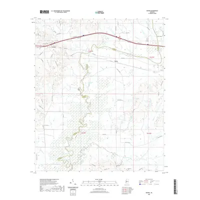
2020 Map of Bovina
USGS Topo · Published 2020About this map
The Big Black River carves a complex, winding boundary between Warren and Hinds counties, defining the character of this Mississippi landscape. The river’s shifting course has left behind numerous oxbows and landforms, most notably Old River Lake, Horseshoe Lake, and the isolated Tomcat Island. These hydrological features, alongside Gibbs Lake and Little Horseshoe Lake, illustrate the naturally dynamic floodplain that has historically influenced regional land use and settlement patterns.
Find a feature on this map
59 named features on this map. Tap any name to fly to it.
Don’t see what you’re looking for? This feature index may not catch every label — zoom into the map to look around manually.
Map Details
Editions of this 2020 Bovina Map
This is the sole edition of this map. No revisions or reprints were ever made.
Other maps of this area

1918 · Vicksburg
USGS Topo · 1:62,500

1938 · Edwards
USGS Topo · 1:62,500

1939 · Yokena
USGS Topo · 1:62,500

1941 · Vicksburg
USGS Topo · 1:62,500

1955 · Jackson
USGS Topo · 1:250,000

1961 · Jackson
USGS Topo · 1:250,000

1962 · Jackson
USGS Topo · 1:250,000

1962 · Redwood
USGS Topo · 1:24,000

1962 · Vicksburg East
USGS Topo · 1:24,000
1963 · Learned
USGS Topo · 1:24,000