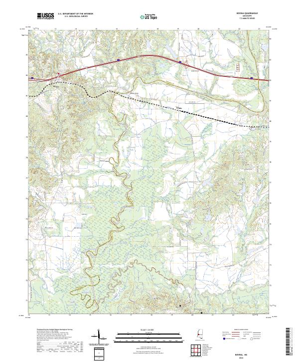
2024 Map of Bovina
USGS Topo · Published 2024About this map
The Big Black River serves as the dominant geographic feature of this landscape, winding through the fertile bottomlands that separate Warren and Hinds counties. This river corridor is marked by numerous oxbow formations and remnants of former channels, including Old River Lake, Horseshoe Lake, and Tomcat Island. The settlement patterns reflect a long history of river-dependent navigation and crossing points, anchored by Bovina and the site of Smiths Ferry.
Find a feature on this map
62 named features on this map. Tap any name to fly to it.
Don’t see what you’re looking for? This feature index may not catch every label — zoom into the map to look around manually.
Map Details
Editions of this 2024 Bovina Map
This is the sole edition of this map. No revisions or reprints were ever made.
Other maps of this area

1918 · Vicksburg
USGS Topo · 1:62,500

1938 · Edwards
USGS Topo · 1:62,500

1939 · Yokena
USGS Topo · 1:62,500

1941 · Vicksburg
USGS Topo · 1:62,500

1955 · Jackson
USGS Topo · 1:250,000

1961 · Jackson
USGS Topo · 1:250,000

1962 · Jackson
USGS Topo · 1:250,000

1962 · Redwood
USGS Topo · 1:24,000

1962 · Vicksburg East
USGS Topo · 1:24,000
1963 · Learned
USGS Topo · 1:24,000