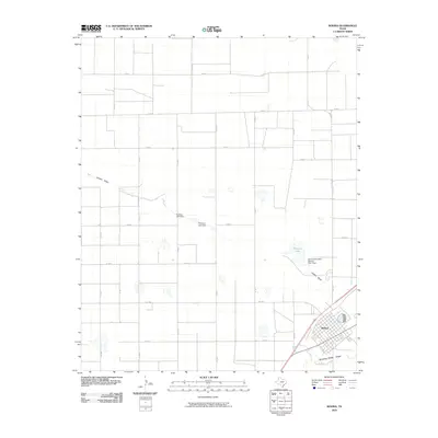
2010 Map of Bovina
USGS Topo · Published 2010About this map
Bovina serves as the primary hub of this High Plains landscape, characterized by a distinct grid of agricultural roads that define the region's ranching and farming character. The terrain is subtly etched by ephemeral drainage systems, most notably Catfish Draw and Running Water Draw, which provide the only natural deviation from the rectilinear survey lines. Water management is central to the area's utility, evidenced by several impoundments including Mustang Lake, Hartzog Lake Dam, and Williams Lake Dam. The presence of the Soil Conservation Service Site 2 Dam reflects modern efforts to manage runoff and soil stability in this semi-arid environment. This map captures the intersection of rural infrastructure and environmental adaptation, where the organized network of county roads like Co RD N and state routes like FM 1731 facilitate the local agricultural economy.
Find a feature on this map
23 named features on this map. Tap any name to fly to it.
Don’t see what you’re looking for? This feature index may not catch every label — zoom into the map to look around manually.
Map Details
Editions of this 2010 Bovina Map
This is the sole edition of this map. No revisions or reprints were ever made.
Other maps of this area

1954 · Clovis
USGS Topo · 1:250,000

1957 · Clovis
USGS Topo · 1:62,500

1957 · Pleasant Hill
USGS Topo · 1:62,500

1958 · Clovis
USGS Topo · 1:250,000

1963 · Oklahoma Lane
USGS Topo · 1:24,000

1963 · Lariat NE
USGS Topo · 1:24,000

1965 · Bovina
USGS Topo · 1:24,000

1965 · Parmerton
USGS Topo · 1:24,000

1965 · Twin Lakes
USGS Topo · 1:24,000

1965 · Rhea
USGS Topo · 1:24,000