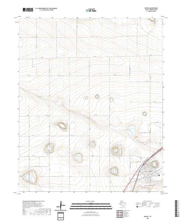
2022 Map of Bovina
USGS Topo · Published 2022About this map
Bovina occupies the southeastern corner of this High Plains landscape, serving as a hub for the surrounding ranching and agricultural region. The town is laid out on a grid system with prominent corridors such as Gardner Ave and W 11th St intersecting near the local center. To the south, the Bovina Cem provides a point of interest for genealogists tracing local families.
Find a feature on this map
38 named features on this map. Tap any name to fly to it.
Don’t see what you’re looking for? This feature index may not catch every label — zoom into the map to look around manually.
Map Details
Editions of this 2022 Bovina Map
This is the sole edition of this map. No revisions or reprints were ever made.
Other maps of this area

1954 · Clovis
USGS Topo · 1:250,000

1957 · Clovis
USGS Topo · 1:62,500

1957 · Pleasant Hill
USGS Topo · 1:62,500

1958 · Clovis
USGS Topo · 1:250,000

1963 · Oklahoma Lane
USGS Topo · 1:24,000

1963 · Lariat NE
USGS Topo · 1:24,000

1965 · Bovina
USGS Topo · 1:24,000

1965 · Parmerton
USGS Topo · 1:24,000

1965 · Twin Lakes
USGS Topo · 1:24,000

1965 · Rhea
USGS Topo · 1:24,000