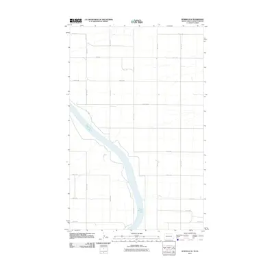
2011 Map of Bowbells NE
USGS Topo · Published 2011About this map
Upper Des Lacs Lake dominates the western portion of this landscape, carving a wide valley through the high plains of the North Dakota-Saskatchewan border region. The area is defined by a rigid section-line road network, including arterial routes such as County Rd-1 and County Rd-2. This grid system, characterized by roads like 109th St NW and 60th Ave NW, reflects the late-nineteenth and early-twentieth-century agrarian development of the Missouri Plateau. The map captures the intersection of natural hydrology and human-imposed geometry, showing how local transit routes like 105th St NW navigate the descent toward the lake's edge. This 2011 edition provides a clear record of rural infrastructure and land management in the northern Great Plains.
Find a feature on this map
17 named features on this map. Tap any name to fly to it.
Don’t see what you’re looking for? This feature index may not catch every label — zoom into the map to look around manually.
Map Details
Editions of this 2011 Bowbells NE Map
This is the sole edition of this map. No revisions or reprints were ever made.
Other maps of this area

1947 · Bowbells NW
USGS Topo · 1:24,000

1947 · Bowbells
USGS Topo · 1:24,000

1948 · Mouse River Park NW
USGS Topo · 1:24,000

1949 · Bowbells
USGS Topo · 1:24,000

1949 · Mouse River Park NW
USGS Topo · 1:24,000

1949 · Bowbells SE
USGS Topo · 1:24,000

1949 · Bowbells NW
USGS Topo · 1:24,000

1949 · Bowbells NE
USGS Topo · 1:24,000

1949 · Mouse River Park SW
USGS Topo · 1:24,000

1950 · Bowbells
USGS Topo · 1:62,500