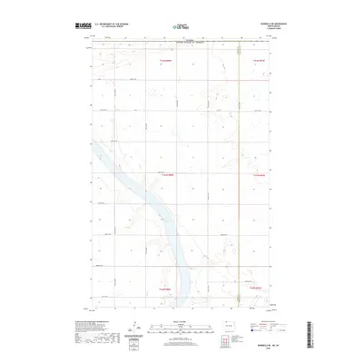
2020 Map of Bowbells NE
USGS Topo · Published 2020About this map
Upper Des Lacs Lake dominates the central corridor of this North Dakota landscape, cutting a deep valley through the northern prairie. This section of the High Plains, mapped in 2020, sits immediately adjacent to the international border, where the rural grid of Burke and Renville counties meets the Canadian province of Saskatchewan. The terrain is defined by the sharp contrast between the flat upland agricultural fields and the wooded, winding coulees that drain into the lake bed. A systematic network of section-line roads, including Co 2 and 108th St Nw, provides access to the remote farmsteads that characterize this borderland region. The map captures the intersection of the Burke and Renville county line as it traverses the lake, illustrating how political boundaries were superimposed upon the natural geography of the Des Lacs River valley.
Find a feature on this map
23 named features on this map. Tap any name to fly to it.
Don’t see what you’re looking for? This feature index may not catch every label — zoom into the map to look around manually.
Map Details
Editions of this 2020 Bowbells NE Map
This is the sole edition of this map. No revisions or reprints were ever made.
Other maps of this area

1947 · Bowbells NW
USGS Topo · 1:24,000

1947 · Bowbells
USGS Topo · 1:24,000

1948 · Mouse River Park NW
USGS Topo · 1:24,000

1949 · Bowbells
USGS Topo · 1:24,000

1949 · Mouse River Park NW
USGS Topo · 1:24,000

1949 · Bowbells SE
USGS Topo · 1:24,000

1949 · Bowbells NW
USGS Topo · 1:24,000

1949 · Bowbells NE
USGS Topo · 1:24,000

1949 · Mouse River Park SW
USGS Topo · 1:24,000

1950 · Bowbells
USGS Topo · 1:62,500