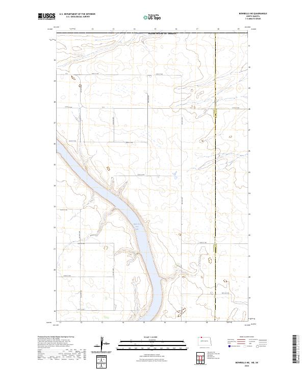
2024 Map of Bowbells NE
USGS Topo · Published 2024About this map
The waters of Upper Des Lacs Lake cut a dramatic northwest-to-southeast diagonal through this northern North Dakota landscape, providing a critical aquatic corridor within the Des Lacs National Wildlife Refuge. This protected habitat dominates the central valley, while the surrounding uplands are defined by the rigid geometry of the Public Land Survey System. The map captures the boundary between Burke County and Renville County, illustrating how the straight-line political borders intersect with the natural contours of the Des Lacs River valley. A dense network of section-line roads, including 108th St NW and 60th Ave NW, facilitates access across the high plains, serving the scattered farmsteads that characterize this agricultural region near the Canadian border.
Find a feature on this map
23 named features on this map. Tap any name to fly to it.
Don’t see what you’re looking for? This feature index may not catch every label — zoom into the map to look around manually.
Map Details
Editions of this 2024 Bowbells NE Map
This is the sole edition of this map. No revisions or reprints were ever made.
Other maps of this area

1947 · Bowbells NW
USGS Topo · 1:24,000

1947 · Bowbells
USGS Topo · 1:24,000

1948 · Mouse River Park NW
USGS Topo · 1:24,000

1949 · Bowbells
USGS Topo · 1:24,000

1949 · Mouse River Park NW
USGS Topo · 1:24,000

1949 · Bowbells SE
USGS Topo · 1:24,000

1949 · Bowbells NW
USGS Topo · 1:24,000

1949 · Bowbells NE
USGS Topo · 1:24,000

1949 · Mouse River Park SW
USGS Topo · 1:24,000

1950 · Bowbells
USGS Topo · 1:62,500