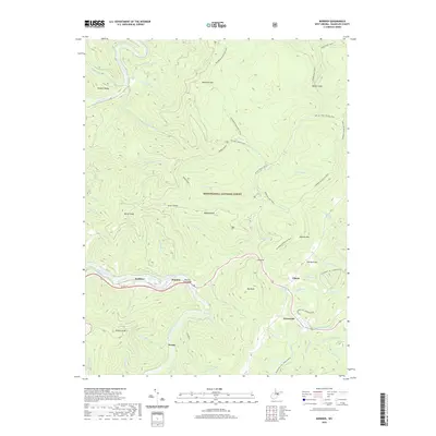
2019 Map of Bowden
USGS Topo · Published 2019About this map
Shavers Fork winds through the heart of the Monongahela National Forest, carving a deep valley that anchors the settlements of Faulkner, Bowden, and Evenwood. This 2019 survey illustrates a landscape dominated by the high ridgelines of Shavers Mtn and McGowan Mtn, where transportation is largely restricted to the Us Rte 33 corridor and an extensive network of footpaths. The map detail highlights the intersection of modern recreation and old mountain life, showing the Shavers Fork Bridge alongside remote points like Weese and Alpena. Numerous small tributaries such as Rattlesnake Run and Stalnaker Run drain into the primary forks, while named summits like Bickle Knob and Big Knob provide significant vertical relief. Local interest is found in specific landmarks such as the Lorraine Burke Spring and the complex of named paths including the McGowan Mountain Trail and Hedrick Camp Trail.
Find a feature on this map
65 named features on this map. Tap any name to fly to it.
Don’t see what you’re looking for? This feature index may not catch every label — zoom into the map to look around manually.
Map Details
Editions of this 2019 Bowden Map
This is the sole edition of this map. No revisions or reprints were ever made.
Other maps of this area

1886 · St. George
USGS Topo · 1:125,000

1889 · Beverly
USGS Topo · 1:125,000

1891 · St. George
USGS Topo · 1:125,000

1892 · Beverly
USGS Topo · 1:125,000

1907 · Belington
USGS Topo · 1:62,500

1908 · Parsons
USGS Topo · 1:62,500

1909 · Elkins
USGS Topo · 1:62,500

1922 · Horton
USGS Topo · 1:48,000

1924 · Horton
USGS Topo · 1:62,500

1926 · Parsons
USGS Topo · 1:62,500