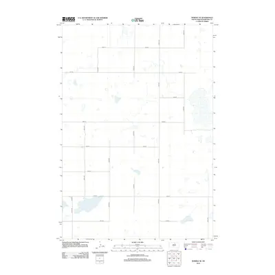
2012 Map of Bowdle SE
USGS Topo · Published 2012About this map
Glacial prairie potholes and seasonal wetlands define this section of Edmunds County, where the landscape is organized by a precise grid of rural section roads. This 2012 survey illustrates the agricultural character of the region just south of the Great Northern railway corridor, though the tracks themselves lie outside these boundaries. Co Hwy 1 serves as a primary north-south artery in the western portion of the map, intersecting east-west routes like 143rd St and 146th St. The irregular shorelines of the numerous small basins contrast with the straight lines of 327th Ave and 334th Ave, revealing how drainage patterns influenced the placement of homesteads and field borders in this part of the Dakotas.
Find a feature on this map
16 named features on this map. Tap any name to fly to it.
Don’t see what you’re looking for? This feature index may not catch every label — zoom into the map to look around manually.
Map Details
Editions of this 2012 Bowdle SE Map
This is the sole edition of this map. No revisions or reprints were ever made.
Other maps of this area

1950 · Onaka
USGS Topo · 1:24,000

1952 · Onaka
USGS Topo · 1:24,000

1954 · Aberdeen
USGS Topo · 1:250,000

1956 · Aberdeen
USGS Topo · 1:250,000

1965 · Onaka
USGS Topo · 1:24,000

1974 · Gretna
USGS Topo · 1:24,000

1974 · Bowdle SE
USGS Topo · 1:24,000

1974 · Roscoe SW
USGS Topo · 1:24,000

1974 · Bowdle
USGS Topo · 1:24,000
1978 · Tolstoy
USGS Topo · 1:24,000