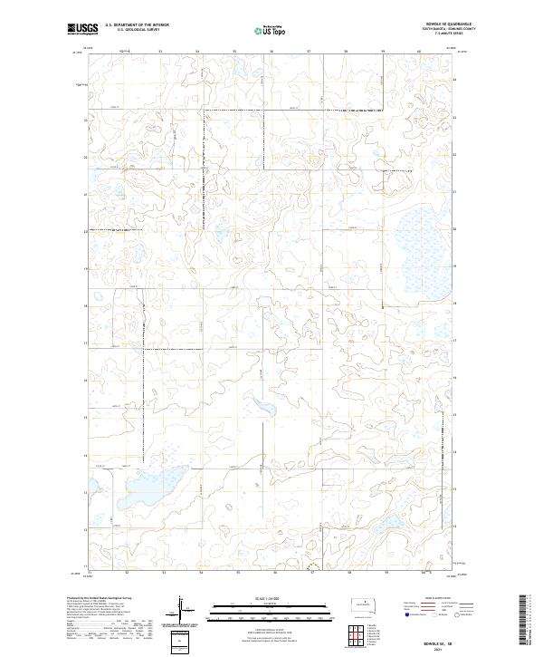
2021 Map of Bowdle SE
USGS Topo · Published 2021About this map
Glacial prairie potholes and seasonal wetlands dominate this landscape in southeastern Edmunds County. The terrain is defined by a rigorous section-line grid of rural roads, including arterial routes like Co Rd 6 and Co Rd 3. This 2021 survey illustrates a sparse, agrarian environment where the natural drainage of the Missouri Coteau creates numerous un-named ponds and basins. The collection of local routes such as 140th St and 147th St provide the primary infrastructure for the region's agricultural operations, connecting remote farmsteads within the townships of t122n r73w and t121n r72w.
Find a feature on this map
22 named features on this map. Tap any name to fly to it.
Don’t see what you’re looking for? This feature index may not catch every label — zoom into the map to look around manually.
Map Details
Editions of this 2021 Bowdle SE Map
This is the sole edition of this map. No revisions or reprints were ever made.
Other maps of this area

1950 · Onaka
USGS Topo · 1:24,000

1952 · Onaka
USGS Topo · 1:24,000

1954 · Aberdeen
USGS Topo · 1:250,000

1956 · Aberdeen
USGS Topo · 1:250,000

1965 · Onaka
USGS Topo · 1:24,000

1974 · Gretna
USGS Topo · 1:24,000

1974 · Bowdle SE
USGS Topo · 1:24,000

1974 · Roscoe SW
USGS Topo · 1:24,000

1974 · Bowdle
USGS Topo · 1:24,000
1978 · Tolstoy
USGS Topo · 1:24,000