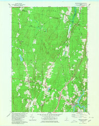
1980 Map of Bowdoinham
USGS Topo · Published 1980About this map
Bowdoinham sits at the confluence of tidal waters and interior woodlands, where the Cathance River meets its West Branch near the Maine Central Railroad. The landscape of 1980 is characterized by small agricultural and residential hubs such as Richmond Corner, Bowdoin Center, and Varney Corner. For the genealogist, the map preserves the locations of numerous family-named burial grounds including Blanchard Cem, Coombs Cem, and Hix Small Cem, which are often located near the historical transport routes of Litchfield Road and Millay Road.
Find a feature on this map
41 named features on this map. Tap any name to fly to it.
Don’t see what you’re looking for? This feature index may not catch every label — zoom into the map to look around manually.
Map Details
Editions of this 1980 Bowdoinham Map
2 editions found
Other maps of this area

1892 · Gardiner
USGS Topo · 1:62,500

1892 · Freeport
USGS Topo · 1:62,500

1894 · Bath
USGS Topo · 1:62,500

1908 · Lewiston
USGS Topo · 1:62,500

1920 · Bath
USGS Topo · 1:62,500

1941 · Freeport
USGS Topo · 1:62,500

1942 · Lewiston
USGS Topo · 1:62,500

1943 · Gardiner
USGS Topo · 1:62,500

1944 · Freeport
USGS Topo · 1:62,500

1945 · Bath
USGS Topo · 1:62,500