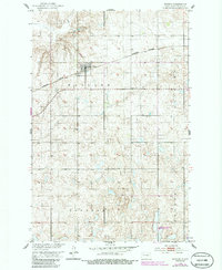
1951 Map of Bowdon
USGS Topo · Published 1986About this map
Bowdon serves as the central hub of this prairie landscape, situated along the Burlington Northern railroad line. The map illustrates a meticulously gridded agricultural region organized into townships like Haaland, Progress, Speedwell, and Berlin. Cultural landmarks significant for genealogical research are scattered across the plains, including the Wayside Cem near the town site and the more remote Mielke Cem to the east. The presence of the Lincoln Sch in the southern portion of the quadrangle suggests the historical distribution of rural education centers before district consolidation. In the southeast, the National Waterfowl Production Area reflects a transition toward conservation in the local land use. Water features are relatively sparse, primarily represented by the winding course of Rocky Run, while industrial activity is noted at a Gravel Pit in the northwest.
Find a feature on this map
14 named features on this map. Tap any name to fly to it.
Don’t see what you’re looking for? This feature index may not catch every label — zoom into the map to look around manually.
Map Details
Editions of this 1951 Bowdon Map
2 editions found
Other maps of this area

1945 · Manfred
USGS Topo · 1:62,500

1948 · Fessenden
USGS Topo · 1:62,500

1948 · Manfred
USGS Topo · 1:62,500

1949 · Fessenden SW
USGS Topo · 1:24,000

1949 · Emrick
USGS Topo · 1:24,000

1950 · Manfred SE
USGS Topo · 1:24,000

1951 · Bowdon
USGS Topo · 1:24,000

1951 · Heaton
USGS Topo · 1:24,000

1952 · New Rockford
USGS Topo · 1:250,000

1956 · New Rockford
USGS Topo · 1:250,000