
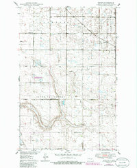
1949 Map of Emrick
USGS Topo · Published 1949About this map
The Minneapolis St Paul and Sault Ste Marie railroad cuts diagonally across this prairie landscape in the late 1940s, anchoring the small settlement of Emrick. This portion of Wells County is characterized by its organized township structure, split between Oshkosh and Germantown, where rural life is centered around local institutions like Oshkosh Sch and Cottonwood Sch.
Find a feature on this map
11 named features on this map. Tap any name to fly to it.
Don’t see what you’re looking for? This feature index may not catch every label — zoom into the map to look around manually.
Map Details
Editions of this 1949 Emrick Map
2 editions found
Other maps of this area

1948 · Cathay
USGS Topo · 1:62,500

1948 · Fessenden
USGS Topo · 1:62,500

1948 · Bremen
USGS Topo · 1:24,000

1949 · Bremen
USGS Topo · 1:24,000

1949 · Cathay
USGS Topo · 1:24,000

1949 · Fessenden SW
USGS Topo · 1:24,000

1949 · Fessenden East
USGS Topo · 1:24,000

1949 · Fessenden West
USGS Topo · 1:24,000

1951 · Bowdon
USGS Topo · 1:24,000

1951 · Heaton
USGS Topo · 1:24,000