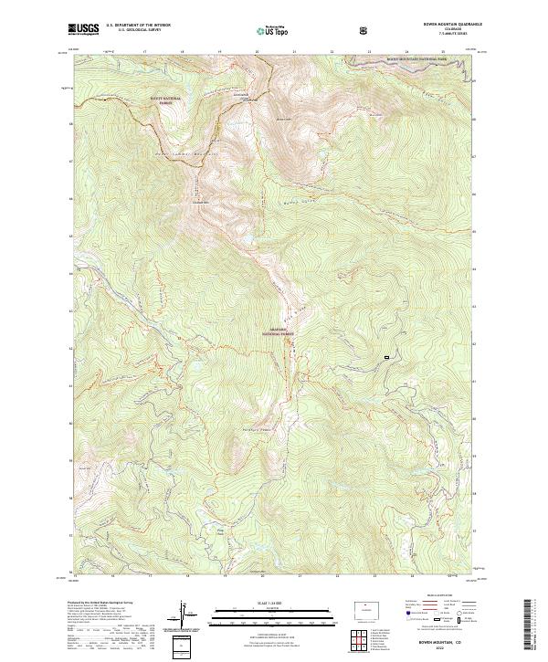
2022 Map of Bowen Mountain
USGS Topo · Published 2022About this map
The Never Summer Mountains dominate the western horizon of this high-elevation terrain, where the boundary between Jackson Co and Grand Co follows the jagged crest of the Continental Divide. This 2022 survey captures a landscape of extreme relief, defined by the industrial-scale engineering of the Grand Ditch, which redirects alpine runoff through the northern reaches of Rocky Mountain National Park. Significant peaks including Bowen Mtn, Cascade Mtn, and Porphyry Peaks tower over a complex network of seasonal drainages and high-country meadows like Pony Park. Below the timberline, the map reveals a dense system of specialized access routes, from the Stillwater Pass road to rugged paths such as the Sherman Creek Single Track Trl, illustrating the overlap of historic resource management and modern wilderness recreation within the Arapaho National Forest.
Find a feature on this map
65 named features on this map. Tap any name to fly to it.
Don’t see what you’re looking for? This feature index may not catch every label — zoom into the map to look around manually.
Map Details
Editions of this 2022 Bowen Mountain Map
This is the sole edition of this map. No revisions or reprints were ever made.
Other maps of this area

1915 · Longs Peak
USGS Topo · 1:125,000

1919 · Rocky Mountain National Park
USGS Topo · 1:125,000

1954 · Greeley
USGS Topo · 1:250,000

1954 · Craig
USGS Topo · 1:250,000

1956 · Radial Mountain
USGS Topo · 1:24,000

1956 · Jack Creek Ranch
USGS Topo · 1:24,000

1956 · Rand
USGS Topo · 1:62,500

1957 · Craig
USGS Topo · 1:250,000

1957 · Greeley
USGS Topo · 1:250,000

1957 · Mount Richthofen
USGS Topo · 1:24,000