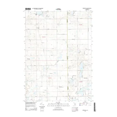
2014 Map of Bowens Mill
USGS Topo · Published 2014About this map
Bowens Mill and the surrounding lake country of the Allegan and Barry county line are documented here in high detail. The landscape is defined by its numerous water bodies, including the expansive Gun Lake and the smaller Barlow Lake, which are interconnected by a network of drainage systems like the Rabbit River and Fales Drain. The settlement pattern reflects the area's rural and recreational character, with the village of Corning and the namesake Bowens Mill serving as local anchors. Genealogists will find several burial grounds noted, such as Saints Cyril and Methodius Catholic Cem and the Hooker Cem. The map illustrates a dense grid of numbered county roads, like 135th Ave and 142nd Ave, which provide access to the various lakefronts and farmsteads. The inclusion of the Mill Pond near Gun Lake suggests the historical industrial utility of the area's water resources within the broader agricultural landscape.
Find a feature on this map
72 named features on this map. Tap any name to fly to it.
Don’t see what you’re looking for? This feature index may not catch every label — zoom into the map to look around manually.
Map Details
Editions of this 2014 Bowens Mill Map
This is the sole edition of this map. No revisions or reprints were ever made.
Other maps of this area

1914 · Grand Rapids
USGS Topo · 1:62,500

1918 · Lowell
USGS Topo · 1:62,500

1943 · Grand Rapids
USGS Topo · 1:62,500

1943 · Lowell
USGS Topo · 1:62,500

1951 · Hastings
USGS Topo · 1:62,500

1958 · Grand Rapids
USGS Topo · 1:250,000

1959 · Wayland
USGS Topo · 1:62,500

1961 · Grand Rapids
USGS Topo · 1:250,000

1962 · Grand Rapids
USGS Topo · 1:250,000
1967 · Cutlerville
USGS Topo · 1:24,000