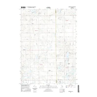
2017 Map of Bowens Mill
USGS Topo · Published 2017About this map
Wayland and the crossroads of Bowens Mill anchor this landscape along the border of Allegan and Barry counties. The area is defined by a dense concentration of glacial lakes and an intricate drainage network including the Rabbit River, Fales Drain, and McIntire Lake Drain. This topography shaped the early development of the region, where water power and irrigation supported small agricultural hubs. Notable for genealogists and local historians, the sheet identifies numerous historical burial grounds like Hooker Cem, Hill Cem, and the Saints Cyril and Methodius Catholic Cem. The settlement at Corning and the various mills suggest a late-19th-century economy transitioning into the modern era, with significant recreational lakes such as Gun Lake and Barlow Lake becoming prominent features of the rural environment.
Find a feature on this map
82 named features on this map. Tap any name to fly to it.
Don’t see what you’re looking for? This feature index may not catch every label — zoom into the map to look around manually.
Map Details
Editions of this 2017 Bowens Mill Map
This is the sole edition of this map. No revisions or reprints were ever made.
Other maps of this area

1914 · Grand Rapids
USGS Topo · 1:62,500

1918 · Lowell
USGS Topo · 1:62,500

1943 · Grand Rapids
USGS Topo · 1:62,500

1943 · Lowell
USGS Topo · 1:62,500

1951 · Hastings
USGS Topo · 1:62,500

1958 · Grand Rapids
USGS Topo · 1:250,000

1959 · Wayland
USGS Topo · 1:62,500

1961 · Grand Rapids
USGS Topo · 1:250,000

1962 · Grand Rapids
USGS Topo · 1:250,000
1967 · Cutlerville
USGS Topo · 1:24,000