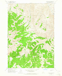
1963 Map of Bowery Peak
USGS Topo · Published 1964About this map
Bowery Peak towers over a complex drainage system in this high-elevation landscape where the Challis National Forest meets the Sawtooth National Forest. An Indefinite Boundary weaves through the terrain, marking a division between the primary forest lands. Human movement through these peaks is evidenced by the McDonald Trail and the presence of a Footbridge over West Fork Herd Creek, indicating a reliance on backcountry paths for transit between the high ridges and the valleys of Herd Creek and Middle Canyon Creek. The mapping of prominent summits like Sheep Mtn alongside smaller features such as Taylor Creek and Lake Cr provides a technical look at the watershed's structure during the early 1960s, a period before significant modern development in these protected mountain ranges.
Find a feature on this map
22 named features on this map. Tap any name to fly to it.
Don’t see what you’re looking for? This feature index may not catch every label — zoom into the map to look around manually.
Map Details
Editions of this 1963 Bowery Peak Map
This is the sole edition of this map. No revisions or reprints were ever made.
Other maps of this area

1895 · Hailey
USGS Topo · 1:125,000

1897 · Hailey
USGS Topo · 1:125,000

1929 · Bayhorse
USGS Topo · 1:125,000

1955 · Hailey
USGS Topo · 1:250,000

1957 · Challis
USGS Topo · 1:250,000

1959 · Hailey
USGS Topo · 1:250,000

1960 · Challis
USGS Topo · 1:250,000

1962 · Hailey
USGS Topo · 1:250,000

1963 · Challis
USGS Topo · 1:250,000
1963 · Ziegler Basin
USGS Topo · 1:24,000