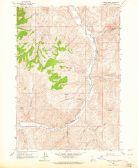
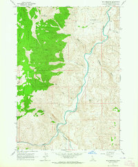
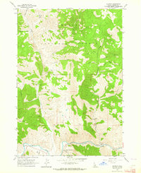
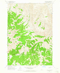
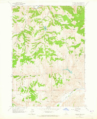
1963 Map of Ziegler Basin
USGS Topo · Published 1964About this map
The East Fork Salmon River carves a deep path through this high-altitude landscape within the Challis National Forest. Mining activity is represented by the Mule Shoe Mine near the northern boundary, while the surrounding terrain is defined by a series of high basins and drainages, including Woods Basin, Joe Jump Basin, and Ziegler Basin. This 1963 survey illustrates a wilderness primarily accessible by primitive routes, featuring numerous trails and jeep trails that navigate the steep breaks between water sources like LMB Spring and Marco Spring.
Find a feature on this map
23 named features on this map. Tap any name to fly to it.
Don’t see what you’re looking for? This feature index may not catch every label — zoom into the map to look around manually.
Map Details
Editions of this 1963 Ziegler Basin Map
This is the sole edition of this map. No revisions or reprints were ever made.
Other maps of this area

1929 · Bayhorse
USGS Topo · 1:125,000

1957 · Challis
USGS Topo · 1:250,000

1960 · Challis
USGS Topo · 1:250,000

1963 · Challis
USGS Topo · 1:250,000
1963 · Bald Mountain
USGS Topo · 1:24,000
1963 · Clayton
USGS Topo · 1:24,000
1963 · Bowery Peak
USGS Topo · 1:24,000
1963 · Potaman Peak
USGS Topo · 1:24,000
1963 · Clayton
USGS Topo · 1:62,500

1963 · Lone Pine Peak
USGS Topo · 1:62,500