
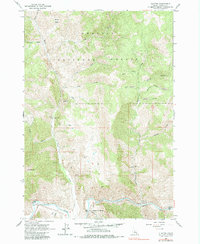
1963 Map of Clayton
USGS Topo · Published 1964About this map
Clayton serves as the focal point of this 1960s study, situated along the northern banks of the Salmon River within the Challis National Forest. The landscape is deeply tied to extraction and utility, evidenced by the industrial footprint of the Clayton Mine and its associated Tailings Pond, as well as the Kinnikinic Aqueduct and a Tramway system. Further exploration into the mountain slopes reveals the Redbird Mine and South Butte Mine, connected by a network of steep trails and unimproved roads.
Find a feature on this map
66 named features on this map. Tap any name to fly to it.
Don’t see what you’re looking for? This feature index may not catch every label — zoom into the map to look around manually.
Map Details
Editions of this 1963 Clayton Map
2 editions found
Other maps of this area

1919 · Custer
USGS Topo · 1:125,000

1922 · Custer
USGS Topo · 1:125,000

1929 · Bayhorse
USGS Topo · 1:125,000

1957 · Challis
USGS Topo · 1:250,000

1960 · Challis
USGS Topo · 1:250,000

1963 · Challis
USGS Topo · 1:250,000

1963 · Bald Mountain
USGS Topo · 1:24,000

1963 · Bayhorse Lake
USGS Topo · 1:24,000
1963 · Elevenmile Creek
USGS Topo · 1:24,000

1963 · Bayhorse
USGS Topo · 1:24,000