2023 Map of Bowie
USGS Topo · Published 2023About this map
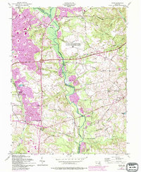
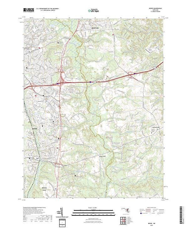
The Patuxent River and its tributary, the Little Patuxent River, define the landscape of this Maryland corridor as it appeared in the early 21st century. The map reveals a dense network of suburban development intertwined with historic rural remnants, particularly along the border of Prince George's County and Anne Arundel County. Key transportation arteries like Annapolis Rd and Central Ave connect established communities like Bowie, Crofton, and Davidsonville. For genealogists and local historians, the sheet is notably rich in small family burial grounds and churchyards, such as the Benjimin Ogle Family Cem and the Peach Walker Family Cem. These sites, alongside historic congregational centers like Saint Matthews United Methodist Church and the Sacred Heart Catholic Cem, provide a precise record of the area's ancestral footprint amid modern expansion.
Find a feature on this map
44 named features on this map. Tap any name to fly to it.
Don’t see what you’re looking for? This feature index may not catch every label — zoom into the map to look around manually.
Map Details
Editions of this 2023 Bowie Map
This is the sole edition of this map. No revisions or reprints were ever made.