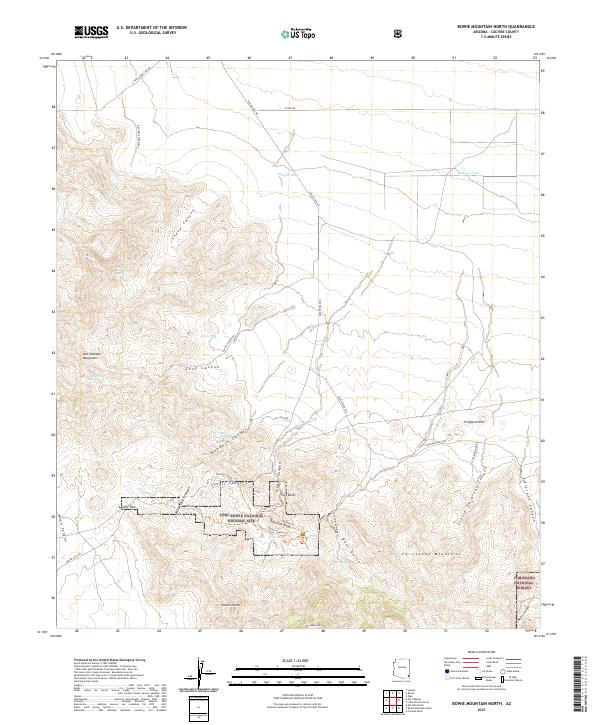
2021 Map of Bowie Mountain North
USGS Topo · Published 2021About this map
Fort Bowie National Historic Site anchors the southern portion of this landscape, marking the strategic gap between the Dos Cabezas Mountains and the Chiricahua Mountains. This rugged Arizona terrain is defined by the historic passage of the Butterfield Trl, which winds through Apache Pass past the critical waters of Apache Spring. The network of paths including the Visitor Center Trl and Return Trl reveals the concentrated activity around the old military post. Beyond the historic site, the map illustrates a landscape of high desert drainage and steep relief, from the heights of Helens Dome and Bowie Mtn to the deep incisions of Goodwin Canyon and Siphon Canyon. Cattle tanks like Maggie Tank and Red Tank are scattered across the northern flats, indicating the ongoing use of the area for ranching amidst the protected land of the Coronado National Forest.
Find a feature on this map
50 named features on this map. Tap any name to fly to it.
Don’t see what you’re looking for? This feature index may not catch every label — zoom into the map to look around manually.
Map Details
Editions of this 2021 Bowie Mountain North Map
This is the sole edition of this map. No revisions or reprints were ever made.
Other maps of this area

1917 · San Simon
USGS Topo · 1:125,000

1922 · Willcox
USGS Topo · 1:125,000

1926 · Cochise Head
USGS Topo · 1:62,500

1928 · Bowie
USGS Topo · 1:62,500

1943 · Dos Cabezas
USGS Topo · 1:62,500

1944 · Fisher Hills
USGS Topo · 1:62,500

1949 · Bowie
USGS Topo · 1:62,500

1950 · Bowie
USGS Topo · 1:62,500

1950 · Cochise Head
USGS Topo · 1:62,500

1954 · Silver City
USGS Topo · 1:250,000