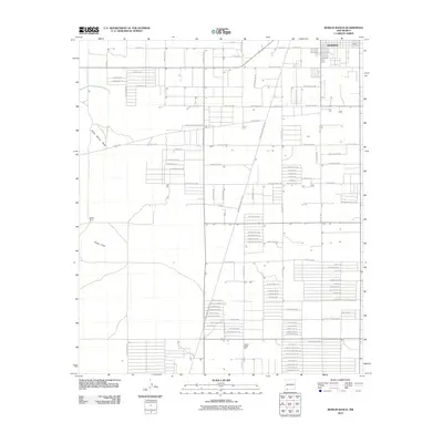
2010 Map of Bowlin Ranch
USGS Topo · Published 2010About this map
Deming anchors the northeastern corner of this high-desert landscape, where the southern outskirts of the city give way to a sprawling grid of rural development and ranch land in the early 21st century. The terrain is defined by the Snake Hills to the west and the seasonal drainage of Jones Spring Draw. A sophisticated network of thoroughfares, including Hermanas Grade Rd Sw and Red Mountain Way Sw, connects isolated properties and agricultural holdings across the basin. Local industry and land use are reflected in the presence of the Copper Ridge Mill in the south-central portion of the quadrangle, while the Bowlin Ranch and the small settlement of Wiese mark the northern and western reaches. The naming of roads like El Bordo Rd Sw and Kachina Rd Sw provides a glimpse into the regional cultural identity at the time of the survey.
Find a feature on this map
99 named features on this map. Tap any name to fly to it.
Don’t see what you’re looking for? This feature index may not catch every label — zoom into the map to look around manually.
Map Details
Editions of this 2010 Bowlin Ranch Map
This is the sole edition of this map. No revisions or reprints were ever made.
Other maps of this area

1899 · Deming
USGS Topo · 1:125,000

1915 · Deming
USGS Topo · 1:125,000

1955 · Las Cruces
USGS Topo · 1:250,000

1958 · Las Cruces
USGS Topo · 1:250,000

1964 · Deming West
USGS Topo · 1:24,000
1964 · Williams Ranch
USGS Topo · 1:24,000

1965 · South Peak
USGS Topo · 1:24,000

1965 · Deming East
USGS Topo · 1:24,000
1965 · Midway Butte
USGS Topo · 1:24,000
1965 · Red Mountain
USGS Topo · 1:24,000