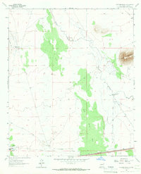
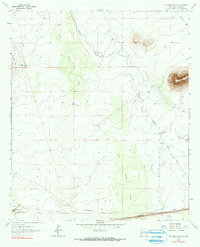
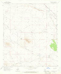
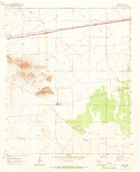
1964 Map of Williams Ranch
USGS Topo · Published 1967About this map
Williams Ranch sits at the heart of this high-desert landscape in Luna County during the mid-1960s. The seasonal Mimbres River tracks through the eastern portion of the quadrangle, supported by a network of water management features including the Wamel Canal, a Gaging Sta, and isolated points like Middle Well. The topography is defined by the prominent Black Mountain in the east and Clabber Top Hill to the west, with the distinctive Jones Spring Draw cutting a north-south path through the center.
Find a feature on this map
22 named features on this map. Tap any name to fly to it.
Don’t see what you’re looking for? This feature index may not catch every label — zoom into the map to look around manually.
Map Details
Editions of this 1964 Williams Ranch Map
2 editions found
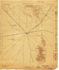
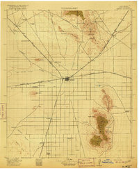
Other maps of this area
1899 · Deming
USGS Topo · 1:125,000
1915 · Deming
USGS Topo · 1:125,000

1954 · Silver City
USGS Topo · 1:250,000

1955 · Las Cruces
USGS Topo · 1:250,000

1958 · Las Cruces
USGS Topo · 1:250,000

1958 · Silver City
USGS Topo · 1:250,000

1962 · Silver City
USGS Topo · 1:250,000
1963 · Antelope Hill
USGS Topo · 1:24,000
1963 · Gage
USGS Topo · 1:24,000

1964 · Grandmother Mountain East
USGS Topo · 1:24,000