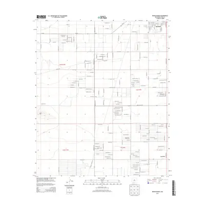
2013 Map of Bowlin Ranch
USGS Topo · Published 2013About this map
The high desert landscape of Deming unfolds south toward the Mexico border, defined by an orderly grid of ranch roads and residential developments under the jurisdiction of Luna County. To the west, the Snake Hills rise from the basin floor, providing a natural break in the terrain near Bowlin Ranch. The map captures a moment of transition as traditional agricultural holdings and the settlement of Sunshine are increasingly overlaid with a complex network of planned streets and avenues, including family and resource-named thoroughfares like S Gold Ave and S Silver Ave. Modern infrastructure is represented by a private Runway and utility corridors such as Pipeline Rd, while the orientation of routes like Hermanas Grade Rd SW and Columbus Rd SW highlights the region's historic connections to southern border communities.
Find a feature on this map
155 named features on this map. Tap any name to fly to it.
Don’t see what you’re looking for? This feature index may not catch every label — zoom into the map to look around manually.
Map Details
Editions of this 2013 Bowlin Ranch Map
This is the sole edition of this map. No revisions or reprints were ever made.
Other maps of this area

1899 · Deming
USGS Topo · 1:125,000

1915 · Deming
USGS Topo · 1:125,000

1955 · Las Cruces
USGS Topo · 1:250,000

1958 · Las Cruces
USGS Topo · 1:250,000

1964 · Deming West
USGS Topo · 1:24,000
1964 · Williams Ranch
USGS Topo · 1:24,000

1965 · South Peak
USGS Topo · 1:24,000

1965 · Deming East
USGS Topo · 1:24,000
1965 · Midway Butte
USGS Topo · 1:24,000
1965 · Red Mountain
USGS Topo · 1:24,000