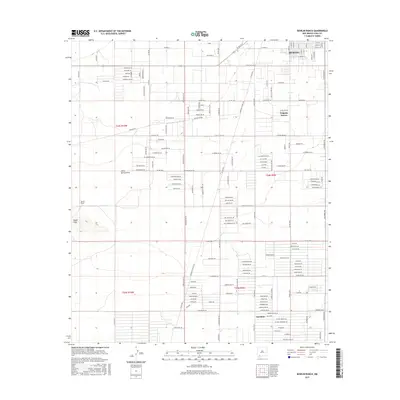
2017 Map of Bowlin Ranch
USGS Topo · Published 2017About this map
Deming anchors the northeastern corner of this Chihuahuan Desert landscape, showing the southern reach of the city's grid near W Pear St and S Gold Ave. The terrain is defined by the alluvial drainage of Jones Spring Draw and the prominent rising of the Snake Hills to the southwest. This area reflects a structured desert settlement pattern, with long arterial routes like Columbus Rd and Hermanas Rd Sw cutting across the basin. Away from the urban center, the map identifies localized ranching and community hubs such as Bowlin Ranch and Sunshine, alongside the distinctively named Pulpotio Bareas. The dense network of named roads, including Spanish Trl Sw and Majestic View Rd, suggests a modern era of rural subdivision and desert development south of the main city center.
Find a feature on this map
159 named features on this map. Tap any name to fly to it.
Don’t see what you’re looking for? This feature index may not catch every label — zoom into the map to look around manually.
Map Details
Editions of this 2017 Bowlin Ranch Map
This is the sole edition of this map. No revisions or reprints were ever made.
Other maps of this area

1899 · Deming
USGS Topo · 1:125,000

1915 · Deming
USGS Topo · 1:125,000

1955 · Las Cruces
USGS Topo · 1:250,000

1958 · Las Cruces
USGS Topo · 1:250,000

1964 · Deming West
USGS Topo · 1:24,000
1964 · Williams Ranch
USGS Topo · 1:24,000

1965 · South Peak
USGS Topo · 1:24,000

1965 · Deming East
USGS Topo · 1:24,000
1965 · Midway Butte
USGS Topo · 1:24,000
1965 · Red Mountain
USGS Topo · 1:24,000