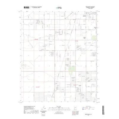
2023 Map of Bowlin Ranch
USGS Topo · Published 2023About this map
Deming anchors the northern reaches of this Luna County landscape, where the Chihuahuan Desert meets expanding residential street grids. The layout reveals a transition from the structured urban blocks of the city to the sprawling rural subdivisions and agricultural tracts further south. Settlements like Sunshine and Mountain View appear amidst a web of named roads, reflecting the 21st-century residential patterns that define the periphery of the Mimbres Valley.
Find a feature on this map
155 named features on this map. Tap any name to fly to it.
Don’t see what you’re looking for? This feature index may not catch every label — zoom into the map to look around manually.
Map Details
Editions of this 2023 Bowlin Ranch Map
This is the sole edition of this map. No revisions or reprints were ever made.
Other maps of this area

1899 · Deming
USGS Topo · 1:125,000

1915 · Deming
USGS Topo · 1:125,000

1955 · Las Cruces
USGS Topo · 1:250,000

1958 · Las Cruces
USGS Topo · 1:250,000

1964 · Deming West
USGS Topo · 1:24,000
1964 · Williams Ranch
USGS Topo · 1:24,000

1965 · South Peak
USGS Topo · 1:24,000

1965 · Deming East
USGS Topo · 1:24,000
1965 · Midway Butte
USGS Topo · 1:24,000
1965 · Red Mountain
USGS Topo · 1:24,000