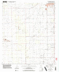
1996 Map of Bowlin Ranch
USGS Topo · Published 2003About this map
The agricultural and desert landscape of Deming stretches southward across this mid-1990s survey, defined by a sparse network of ranching outposts and infrastructure. Along the northeastern edge, the South Park neighborhood and nearby Sunshine Sch reflect the community's outward growth into the arid flats. The map is centered on large-scale land management, evidenced by the extensive Pipeline corridors and several Gravel Pits and Sandpits that supported local road and industrial development.
Find a feature on this map
13 named features on this map. Tap any name to fly to it.
Don’t see what you’re looking for? This feature index may not catch every label — zoom into the map to look around manually.
Map Details
Editions of this 1996 Bowlin Ranch Map
This is the sole edition of this map. No revisions or reprints were ever made.
Other maps of this area

1899 · Deming
USGS Topo · 1:125,000

1915 · Deming
USGS Topo · 1:125,000

1955 · Las Cruces
USGS Topo · 1:250,000

1958 · Las Cruces
USGS Topo · 1:250,000

1964 · Deming West
USGS Topo · 1:24,000
1964 · Williams Ranch
USGS Topo · 1:24,000

1965 · South Peak
USGS Topo · 1:24,000

1965 · Deming East
USGS Topo · 1:24,000
1965 · Midway Butte
USGS Topo · 1:24,000
1965 · Red Mountain
USGS Topo · 1:24,000